St-Vith, Liège province, Belgium. A vital road junction that anchored the American defence of the central Ardennes sector. The 7th Armored Division and elements of the 106th Infantry Division held the town and its approaches from 17 to 21 December 1944 before withdrawing under heavy pressure from three German divisions.
Situation mapDisposition of US and German troops, 16 December 1944Figure 2 from Barber’s study showing the positions of all US and German divisions along the Ardennes front at the moment the offensive was launched. St-Vith is visible at centre-left, defended by VIII Corps. The map shows the full extent of the German attack frontage from Monschau to Echternach.(Barber, The German Ardennes Counteroffensive, 1948, Fig. 2)
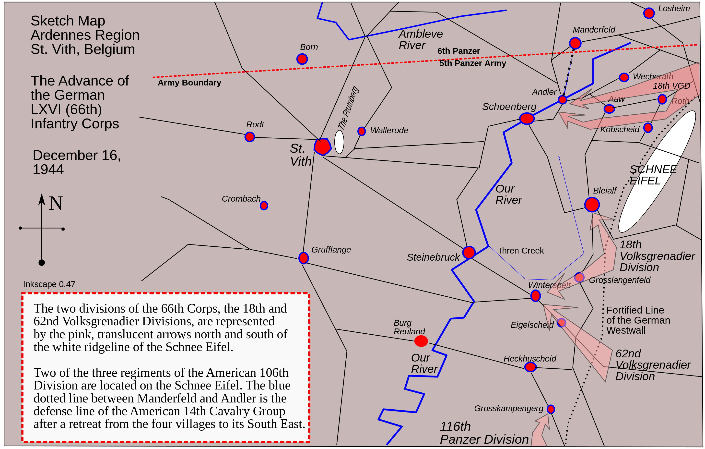
Sketch mapLXVI. Armeekorps attack, 16 December 1944Detailed sketch map showing the first day of the German LXVI Corps attack toward St-Vith. The 18. and 62. Volksgrenadier-Divisionen advance along axes north and south of the Schnee Eifel, aiming to encircle the two regiments of the 106th Infantry Division positioned on the ridge. The blue dotted line shows the 14th Cavalry Group defence line between Manderfeld and Andler.Sketch map, unknown source.
Operational mapSchoenberg area: German attack axes, 19–23 December 1944Map showing the main axes of the German attacks in the Schoenberg area east of St-Vith between 19 and 23 December 1944. The Prumerberg and Lindscheid study sites are marked. Arrows show the German advance from the Our River crossings toward St-Vith from the east and northeast.Academic study map.
.jpg)
.png)